File:Tibet Karte Topograpisch.png
Size of this preview: 800 × 540 pixels. Other resolutions: 320 × 216 pixels | 640 × 432 pixels | 1,024 × 691 pixels | 1,500 × 1,012 pixels.
Original file (1,500 × 1,012 pixels, file size: 3.08 MB, MIME type: image/png)
| This is a file from the Wikimedia Commons. The description on its description page there is shown below.
|
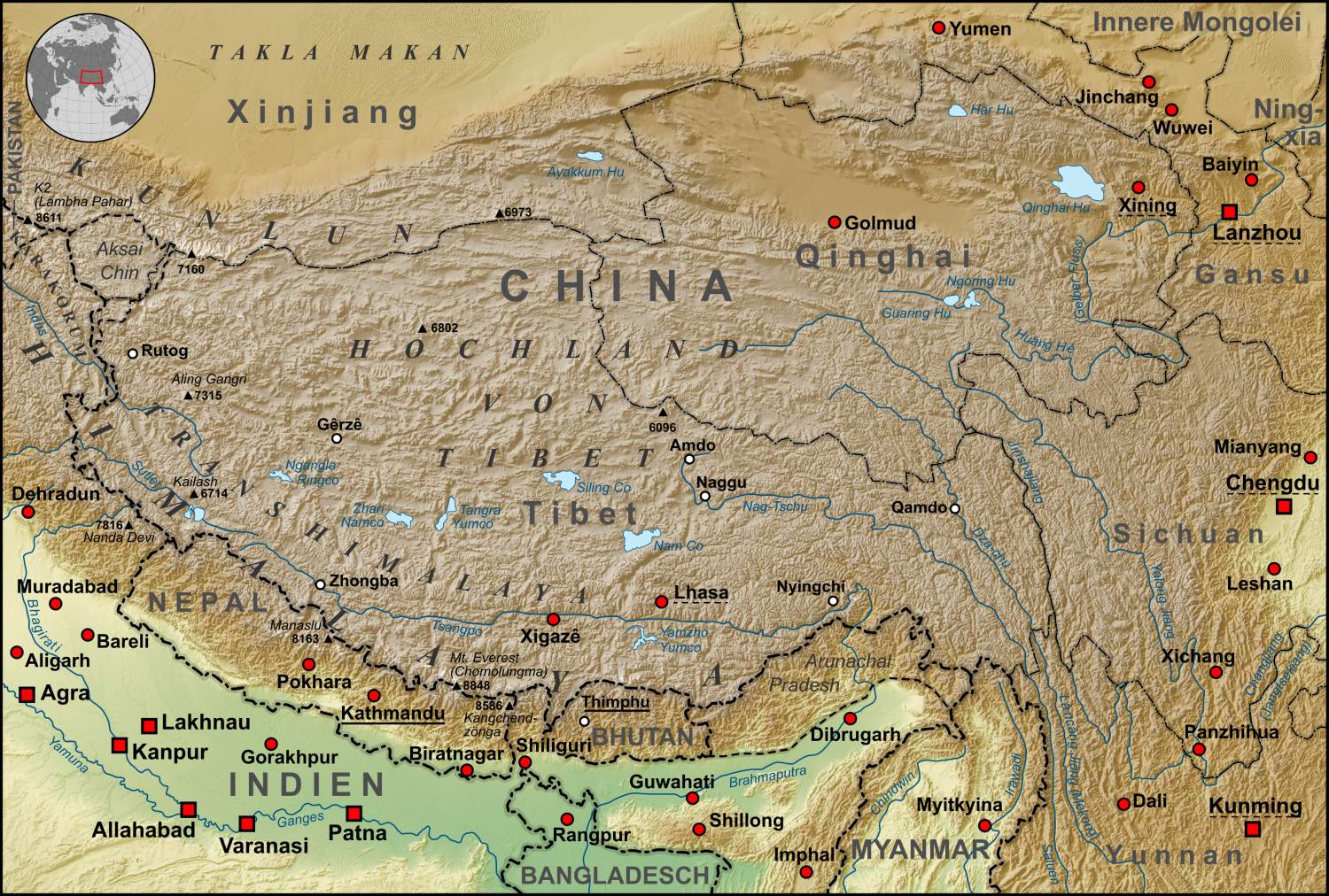
| Description | Topographische Karte der chinesischen autonomen Provinz Tibet, sowie der umliegenden chinesischen Provinzen und der angrenzenden Länder |
| Date | |
| Source |
own work, used:
|
| Author | Lencer |
| Other versions | Derivative works of this file: ZabuyeLake1.png |
This file is licensed under the Creative Commons Attribution-Share Alike 3.0 Unported license.
- You are free:
- to share – to copy, distribute and transmit the work
- to remix – to adapt the work
- Under the following conditions:
- attribution – You must give appropriate credit, provide a link to the license, and indicate if changes were made. You may do so in any reasonable manner, but not in any way that suggests the licensor endorses you or your use.
- share alike – If you remix, transform, or build upon the material, you must distribute your contributions under the same or compatible license as the original.

|
This map has been made or improved in the German Kartenwerkstatt (Map Lab). You can propose maps to improve as well.
|
File history
Click on a date/time to view the file as it appeared at that time.
| Date/Time | Dimensions | User | Comment | |
|---|---|---|---|---|
| current | 23:30, 27 October 2015 | 1,500 × 1,012 (3.08 MB) | Lencer | Ulugh Muztagh now 6973 m |
File usage
The following page uses this file: