
Not Finding Your Answer?
Post It On KidzTalk Homework Help
Post It On KidzTalk Homework Help
Report a search problem

|
mobile version
Copyright 2005-2024 KidzSearch.com
|
|
 | |
 Coat of arms | |
Location of Radebeul within Meißen district | |
| Coordinates: 51°06′N 13°39′E / 51.100°N 13.650°ECoordinates: 51°06′N 13°39′E / 51.100°N 13.650°E | |
| Country | Germany |
| State | Saxony |
| District | Meißen |
| Government | |
| • Mayor | Bert Wendsche |
| Area | |
| • Total | 26.06 km2 (10.06 sq mi) |
| Highest elevation | 256 m (840 ft) |
| Lowest elevation | 101 m (331 ft) |
| Population (2005-09-30) | |
| • Total | 33,091 |
| • Density | 1,269.80/km2 (3,288.8/sq mi) |
| Time zone | UTC+01:00 (CET) |
| • Summer (DST) | UTC+02:00 (CEST) |
| Postal codes | 01435-01445 |
| Vehicle registration | MEI |
| Website | www.radebeul.de |
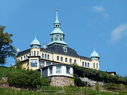
Radebeul is a town (große Kreisstadt) in the district of Meißen in Saxony, Germany, a suburb of Dresden. The Meißen area, where Radebeul is located, is one of the northeasternmost areas where wine is grown today. view more...
